Copyright © 2000-2009, Scott D.
Murdock
26 Dec 2009 - Added additional photos, upgraded existing photos.
Friday, 18 Feb 2000
For several years, I've wanted to visit the former Lufkin AFS. There's not much to see in that neck of the woods, so the trip has been simmering on the back burner. When I recently found the location of Normangee GFA, it made the trek to East Texas doubly worthwhile.
The first stop of the day was the former Lufkin AFS, PIN 3303, 31-25-15, 94-48-15, operated as site TM-193 by the 815th AC&WS. Lufkin AFS was activated on 1 Sep 1957, inactivated on 31 Dec 1960, and transferred to the state of Texas on 8 Dec 1961. At the time of transfer, it consisted of 34.39 fee acres, 2.16 acres in easement, and 57 buildings. It has operated since then as the Lufkin State School. It is a facility for the mentally retarded; and for privacy reasons no photography is allowed. I was fortunate to speak with Jim Kinney, Assistant Superintendent of Administration, and he kindly gave me a brief tour of the facility grounds. There is much new (post-Air Force) construction, in fact there are no Air Force buildings readily visible from the highway. Three two-story dormitories are still in use, as is the recreation/gym building, two well houses, the sewage treatment plant, and several other miscellaneous buildings. The housing area, at the south edge of the site, is also part of the school property. Jim told me there are 21 houses; they originally had flat tar & gravel roofs and cedar siding. They've been remodeled with pitched roofs and vinyl siding. There was no visible trace of radar antenna towers, and Jim had never seen evidence of them in his time at the facility.
I had hoped to see the former Madisonville landing field, 30-57, 95-53. It was listed as an Army emergency landing field in W.W.II airfield directories. Unfortunately, access to the location was blocked by fences and gates.
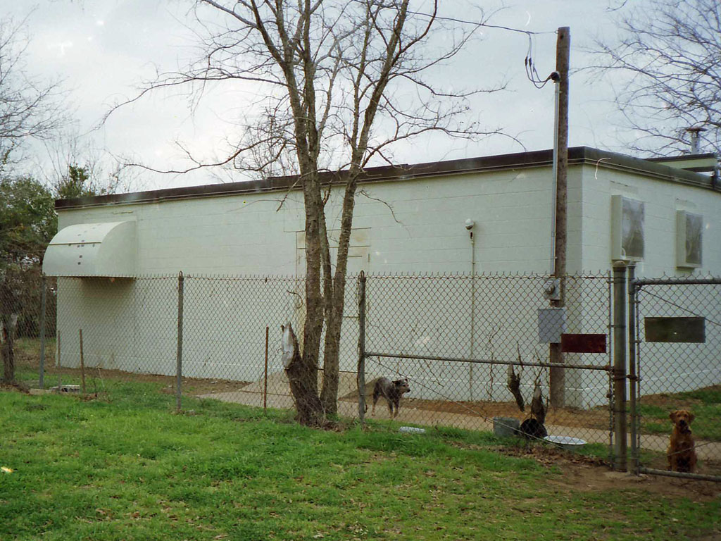
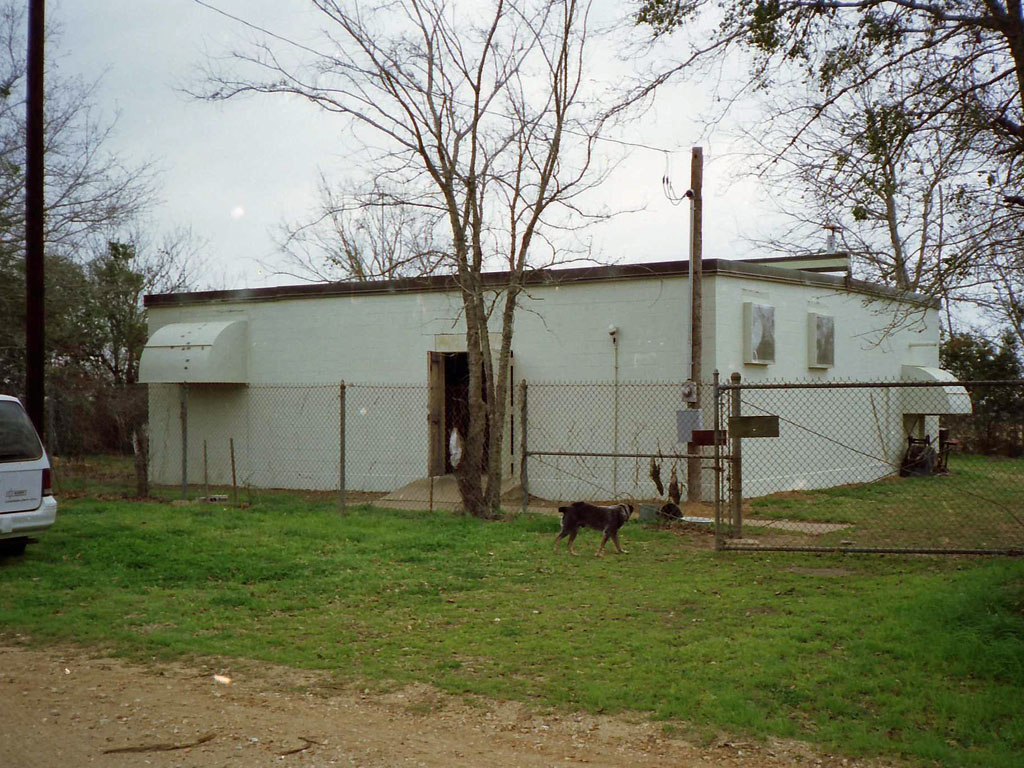
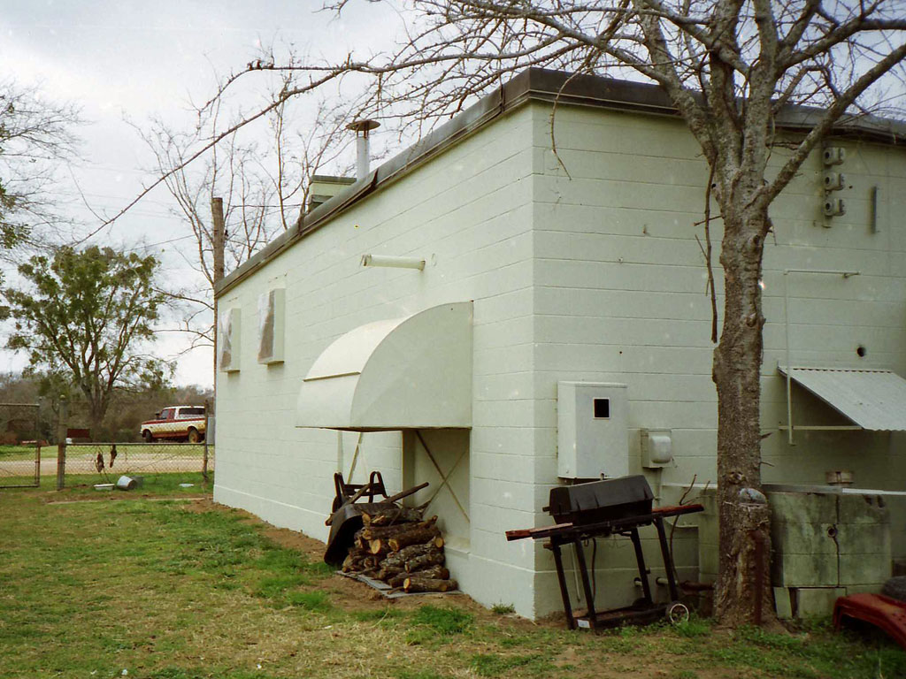
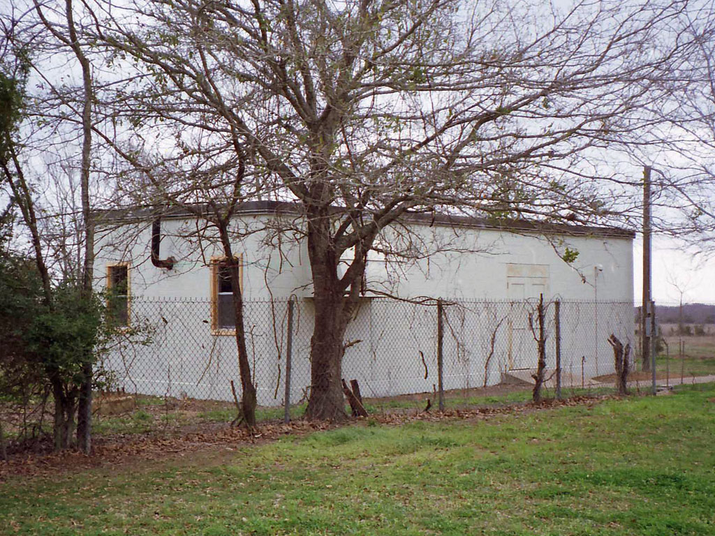
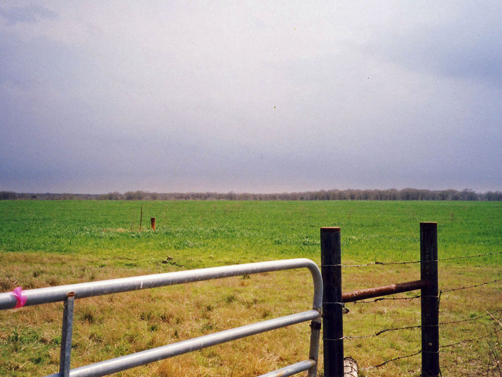
Then I headed west to Normangee GFA, 30-59-35, 96-06-52. This was facility TM-192C, operated by Det 3, 814th AC&WS and supporting Killeen AFS. I haven't found it's dates of operation, but in 1961 it was inspected for disposal by the Government Services Agency. The building is still in good condition. The radar tower was removed before the facility was disposed of, but the three tower foundation supports are still visible, immediately north of the building. and the diesel fuel tank was removed after disposal. While I was admiring the facility from outside the fence, the owner happened to drive up and graciously allowed me inside the fence and even in the building. He bought the site a couple years ago from the school district, which had used it continuously since it was disposed of. He has installed a door between the two rooms, making the space more useable. The two slightly raised pads for the generators were obvious in the generator room. Ha! My first visit to a standard Gap Filler Annex!
Next on the agenda was the former Hammond Intermediate Field, 31-03-30, 96-41-24. I snapped a photo of the field, looking south. USGS maps show an Airway Beacon in the area of the foreground in the photo, but much to my disappointment it was gone. This field was Site 16, GS - WC (Galveston - Waco), in the Civil Aeronautics Administration system. It was also identified in W.W.II airfield directories as used for Army training activities, probably as an emergency landing field. One of these days I will write a short paper on Intermediate Fields, so if you have some expertise on that subject I'd like to hear from you.
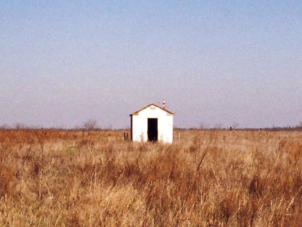
On the trip home, I lucked onto an AT&T coaxial system repeater hut. It was just east of I-45, approximately 32-12-26, 96-28-34. This repeater most likely fed into the Ennis AT&T facility, which is just several miles to the north. The door to the hut was either open or missing, and there was graffiti on the exterior walls.
Made it back to home base in 10 hours, 15 minutes -- total trip was 502 miles.